The purpose of the One Coast, One Community initiative supported by this Coast Diagnosis of the San Diego, Tijuana, and Rosarito region, is to generate and disseminate accessible information about water quality and coastal erosion in the San Diego, Tijuana, and Rosarito region through an open science and citizen participation approach.
This approach aims to facilitate the understanding of climate vulnerability and promote binational community empowerment for greater resilience.
Community members, educators, and local authorities are encouraged to use the report elaborated by Proyecto Fronterizo de Educación Ambiental in 2023 and the interactive dashboard developed by the Permanent Forum of Binational Waters to create their own Water Contamination Map
Justification for the Coast Diagnosis
The increasing frequency of extreme weather events due to climate change highlights the importance of achieving greater coastal resilience.
According to the International Union for Conservation of Nature (IUCN), 94 trillion dollars will be invested in protection infrastructures worldwide in the next 20 years due to climate change.
The United Nations Environment Programme (UNEP) Adaptation Gap Report 2023 likewise highlights that investing in adaptation and mitigation—guided by insights like those in this Coast Diagnosis—can substantially reduce future climate costs.
Read the full Coast Diagnosis Report
In this context, the Tijuana-San Diego region faces significant challenges due to its climate vulnerability and high water stress. Intense and sudden rains, combined with rising temperatures, cause significant damage to the region’s infrastructure.
This Coast Diagnosis highlights how these combined pressures intensify risks to both the environment and local communities.
The projected decrease in rainfall by 2040, combined with high water stress, threatens water availability and exacerbates erosion and contamination problems.
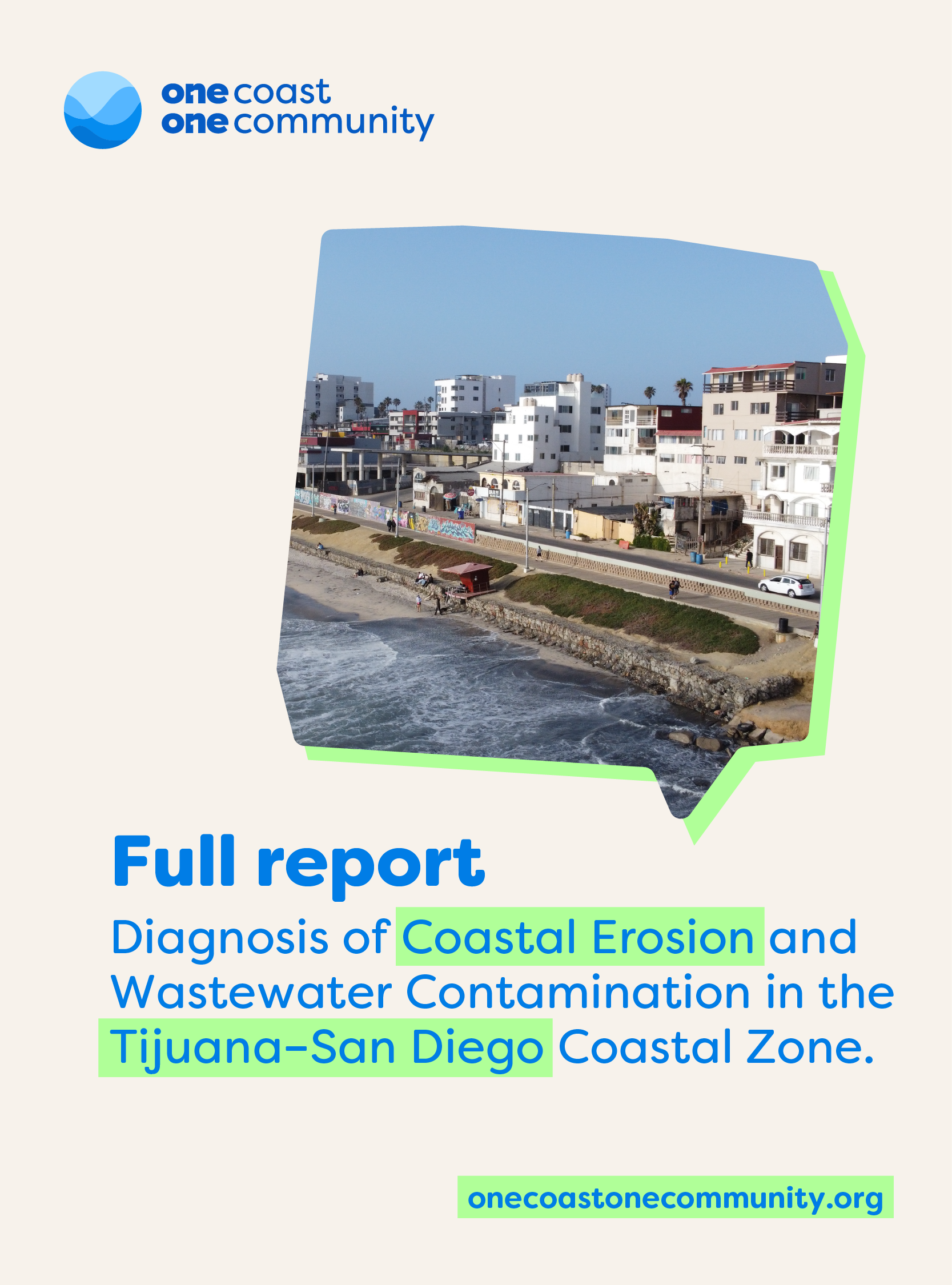
Download the full report “Diagnosis of Coastal Erosion and Wastewater Contamination in the Tijuana–San Diego Coastal Zone”, and explore key findings to support smarter coastal management and cross-border solutions.
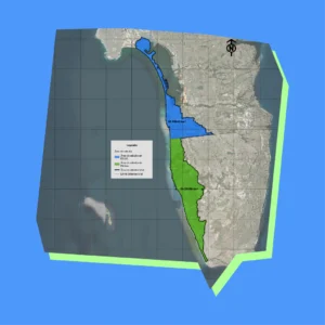
The study area covers a total surface of 102.4 km², with 59.3 km² in Mexico and 43 km² in the United States. The coastal region of the United States includes the cities of Coronado and Imperial Beach, connected by the sandy bar of Silver Strand. In Mexico, the study area covers 24 km of the coastal zone in the municipalities of Tijuana and Playas de Rosarito.
Key Findings
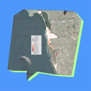
Cliff Erosion
Beach and cliff erosion affects both infrastructure and coastal ecosystems. The region’s mixed geomorphology and the presence of poorly consolidated sedimentary materials exacerbate this problem.
Wastewater Contamination
The discharge of untreated wastewater contaminates marine water, affecting public health and biodiversity. Current sanitation systems are insufficient to handle the volume of wastewater in the region.
Main Problems Identified
Sanitation Infraestructure
The infrastructure for wastewater treatment in the coastal zone is insufficient. It is necessary to improve the operational capacity of these facilities to increase community resilience to adverse conditions.
Water Quality
Marine water quality in the study area is compromised by wastewater and solid waste discharges. Water quality monitoring studies have identified critical contamination points that require immediate attention.
Erosion and Sedimentation
Coastal erosion and Sedimentation are critical problems affecting the stability of infrastructure and the health of marine ecosystems. The combination of natural and anthropogenic factors, such as urban development and industrial activity, exacerbates these problems.
Institutional Instruments
Mexico
Has implemented policies and strategies for coastal management, including the Environmental Strategy for Integrated Coastal Zone Management and the creation of the Intersecretarial Commission for the Sustainable Management of Seas and Coasts. However, there are limitations in the execution and financing of these programs.
United States
Possesses an advanced coastal management system with programs such as the Coastal Zone Management Act and the National Estuary Program. Additionally, the San Diego Association of Governments (SANDAG) has developed coastal monitoring and preservation programs that have provided valuable data for resilience planning.
Conclusions of the Coast Diagnosis Report
The coastal diagnosis reveals that the Tijuana-San Diego coastal zone faces serious challenges related to erosion and water contamination.
Current infrastructures are insufficient to manage the impacts of climate change, and greater coordination and funding are required to implement effective resilience strategies. Binational collaboration and community participation are essential to address these problems comprehensively.
Tools and Data from the Coast Diagnosis
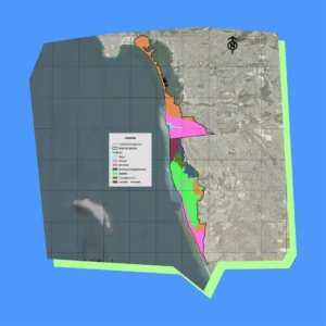
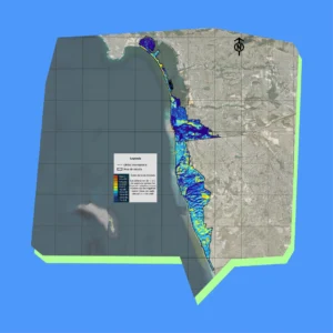
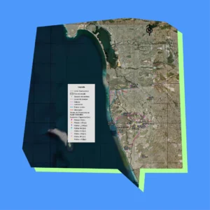
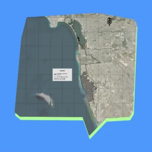
The detailed Coast Diagnosis maps reveal erosion risks, hydrology, and land-use patterns across the Tijuana–San Diego corridor, offering high-resolution files ideal for coastal resilience planning and environmental protection along the U.S.–Mexico border.
These maps, created in 2023 by Proyecto Fronterizo de Educación Ambiental, are complemented by datasets in our interactive dashboard that let you explore and export underlying information for smarter cross-border management strategies.
Mapa 1
Study area
Mapa 2
Popullation
Mapa 3
Population density
Mapa 4
Topography
Mapa 5
Geology
Mapa 6
Slopes
Mapa 7
Contour lines
Mapa 8
Hydrology
Mapa 9
Basin system, subbasin and micro basins
Mapa 10
Uncovered land index
Mapa 11
Eroded land
Mapa 12
Land use
Mapa 13
Unidentified water discharge points
Mapa 14
Infraestructure points
Mapa 15
Social gap
Mapa 16
Areas in Mexico that are not registered in INEGI
Mapa 17
Erosion potential
References
1. Proyecto Fronterizo de Educación Ambiental A.C. (2023). Diagnóstico de Erosión y Contaminación por Aguas Residuales en la Zona Costera de Tijuana-San Diego. Tijuana, México.
2. Union Internacional para la Conservación de la Naturaleza (IUCN). (2023). Informe sobre la Brecha de Adaptación 2023.
3. Programa de Naciones Unidas para el Medio Ambiente (PNUMA). (2023). Informe sobre la Brecha de Adaptación 2023.
4. Secretaría de Medio Ambiente y Recursos Naturales (SEMARNAT). (2022). Estrategia Ambiental para la Gestión Integrada de la Zona Costera. Ciudad de México.
5. Comisión Nacional del Agua (CONAGUA). (2023). Región Hidrológica 1 “Baja California Noroeste”.
6. Asociación de Gobiernos de San Diego (SANDAG). (2023). Programas de Monitoreo y Preservación de la Costa.
7. González, F., & García, R. (2022). Impacto del Cambio Climático en la Infraestructura Costera. Revista de Ingeniería y Medio Ambiente, 45(3), 123-135.
8. Gómez, L. et al. (2023). Impactos de la Contaminación por Aguas Residuales en Ecosistemas Marinos. Revista de Ciencias Ambientales, 78(2), 58-71.
9. Instituto Tecnológico de Tijuana (2023). Estudios de Geomorfología y Hidrología de la Costa Tijuana-San Diego. Tijuana, México.
10. National Oceanic and Atmospheric Administration (NOAA). (2022). Guía de Gestión Costera y Recursos Marinos de California.