COASTAL EROSION AND
Wastewater Pollution
ENHANCING INFRASTRUCTURE, EDUCATION, AND NATURE-BASED SOLUTIONS
Strengthening Our Coast
Introduction
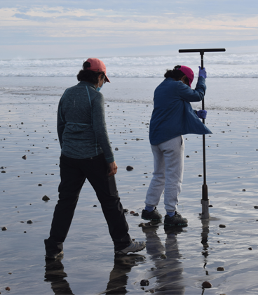
Researchers conducting sampling on the beach
This report, titled “Diagnosis of Coastal Erosion and Wastewater Contamination in the Tijuana-San Diego Coastal Zone,” was developed by Proyecto Fronterizo de Educación Ambiental A.C. in collaboration with the Permanent Forum of Binational Waters, the Instituto Tecnológico de Tijuana, and the City of Imperial Beach. The main objective of this project is to generate and disseminate accessible information about water quality and coastal erosion in the San Diego, Tijuana, and Rosarito region through an open science and citizen participation approach. This approach aims to facilitate the understanding of climate vulnerability and promote binational community empowerment for greater resilience.
Justification
The increasing frequency of extreme weather events due to climate change highlights the importance of achieving greater coastal resilience. According to the International Union for Conservation of Nature (IUCN), 94 trillion dollars will be invested in protection infrastructures worldwide in the next 20 years due to climate change. The United Nations Environment Programme (UNEP) published the Adaptation Gap Report in 2023, emphasizing that investing in adaptation and mitigation can significantly reduce future climate costs.
In this context, the Tijuana-San Diego region faces significant challenges due to its climate vulnerability and high water stress. Intense and sudden rains, combined with rising temperatures, cause significant damage to the region’s infrastructure. The projected decrease in rainfall by 2040, combined with high water stress, threatens water availability and exacerbates coastal erosion and contamination problems.
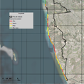
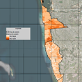
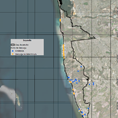
Description of the Study Area
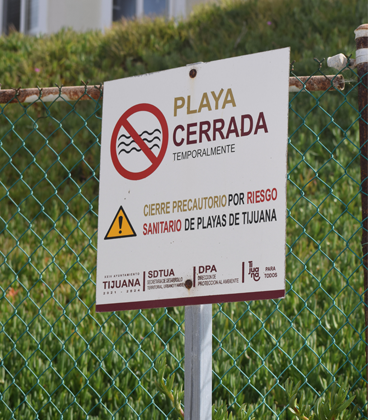
Beach closed due to health risk
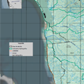
The study area covers a total surface of 102.4 km², with 59.3 km² in Mexico and 43 km² in the United States. The coastal region of the United States includes the cities of Coronado and Imperial Beach, connected by the sandy bar of Silver Strand. In Mexico, the study area covers 24 km of the coastal zone in the municipalities of Tijuana and Playas de Rosarito.
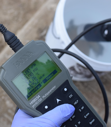
Water quality analysis and monitoring
Main Problems Identified
Key Findings
• Sanitation Infrastructure: The infrastructure for wastewater treatment in the coastal zone is insufficient. It is necessary to improve the operational capacity of these facilities to increase community resilience to adverse conditions.
• Water Quality: Marine water quality in the study area is compromised by wastewater and solid waste discharges. Water quality monitoring studies have identified critical contamination points that require immediate attention.
• Erosion and Sedimentation: Coastal erosion and sedimentation are critical problems affecting the stability of infrastructure and the health of marine ecosystems. The combination of natural and anthropogenic factors, such as urban development and industrial activity, exacerbates these problems.
Institutional Instruments
Conclusions
The diagnosis reveals that the Tijuana-San Diego coastal zone faces serious challenges related to erosion and water contamination. Current infrastructures are insufficient to manage the impacts of climate change, and greater coordination and funding are required to implement effective resilience strategies. Binational collaboration and community participation are essential to address these problems comprehensively.
Recommendations
References
Maps section
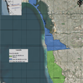
Mapa 1
Área de estudio
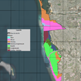
Mapa 2
Geología Superficial de la zona costera de estudio

Mapa 3
Curvas de nivel a 10m en zona de estudio
Mapa 4
Hipsometría de la zona de estudio
Mapa 5
Rangos de pendiente
Mapa 6
Hidrología Superficial

Mapa 7
Sistema de Cuencas, Subcuencas y Microcuencas Costeras
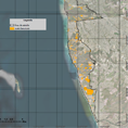
Mapa 8
Índice de Suelo Desnudo
Mapa 9
Suelo Denudado
Mapa 10
Población
Mapa 11
Densidad de Población
Mapa 12
Rezago Social
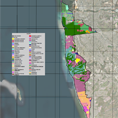
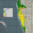
Mapa 13
Usos de Suelo
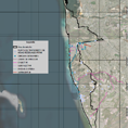
Mapa 14
Localización de Infraestructura Instalada en la Zona de Estudio.
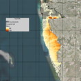
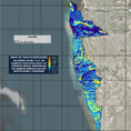
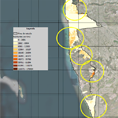
Mapa 15
Potencial de Erosión en la Zona Costera
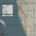
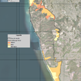
Mapa 16
Localización de Puntos de Descarga no Diferenciada